1. The Corning Glass Works:
This is one of the premier museums in New York. It is associated
with the Steuben Glass Works. There are exhibits on the history of glass,
and fasicinating demonstrations on glass-blowing.

3. Shequaga Falls tumbles
down a steep cliff into the village of Montour Falls. This is one of the best
places to go to understand how such streams are "hanging" above the glacial
trough.
2. Alton Church is found just off of Route 14 in the
small hamlet of Alton, near Sodus. It is the home to one of the finest examples
of a cobblestone building. There are around 500 cobblestones in towns near
Lake Ontario.
1. Montezuma National Wildlife
Refuge is located just north of Cayuga Lake. It is a flat wetland,
a remnant of lakes formed as the Ice Age was ended.
2. Seneca Falls is the home to the Women's Rights National Historic
Park. It was here (in 1848) that the women's rights movement began under
the leadership of Elizabeth Cady Stanton.
4. Museum of the Earth: Located just a couple miles north
of Ithaca is an outstanding new museum about the geologic history of the
Finger Lakes. The fossil collection is first-rate (such as this trilobite).
4. Ithaca is a small college city on the south end of
Cayuga Lake. In the downtown district you find Ithaca Commons, a pedestrial
shopping mall.
5. Kettle Lakes are found scattered near the Valley
Heads Moraine near Spencer. When the glacier paused here, huge chunks of
ice fell off creating depressions that are now filled with water.
|
|
|
|
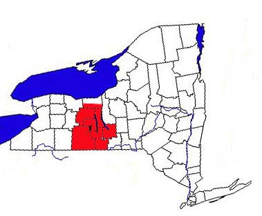
The
Finger Lakes Region (continued):
Traveling Along
Seneca and Cayuga Lakes
WHAT YOU MUST SEE:
ROUTE 14:
Corning/Elmira to Sodus Bay.
1. For some variety, let's do this route in reverse, south to north. The
cities of the Southern Tier are all found along the Susquehanna River
or its major tributaries.
Corning and Elmira are no exceptions. This puts
them in the middle of fertile farm land, but it is also a flood plain.
This fact was brought home when Hurricane Agnes struck in 1971 and flooded
out much of this valley. Look for the signs that tell you the height
of the water during the worst of the flood.
Corning is most famous for Steuben Glass Company and its
excellent Corning Glass Museum. There
are many galleries with glass from all over the world dating back to the
ancient Egypt, and of course, there are demonstrations of glass blowing. As a geographer, don't miss the section on the history of glass in Corning.
QUESTION: Why Corning? This is where geography comes to play. How about transportation, i.e.,
how do you get the fine glass to the big markets? How about fuel for the
furnaces? Corning is close to the Pennsylvania border. What fuel source
is available there?
2. Drive down Rte. 17 to Elmira. This city was one of the many homes
of Samuel Clemens, better known as Mark Twain.
Of course, he hailed originally from Hannibal, Missouri, but Elmira was
the hometown of his wife. They are both buried here. Look for evidences
that "Mark Twain slept here" around the city.
There is a dark side to Elmira's past, the Civil War POW camp,
and many Confederates considered it their Andersonville. Many of the
prisoners who did not survive their capture are buried in the national
cemetery.
QUESTION: Why Elmira? Think
of the city's position to the major battles of the Civil War. Are the
same transportation resources found here as in nearby Corning?
3. Start by driving north on Route 14. You will soon be in the Seneca Trough.
Stop in Montour Falls, the home to several gorges. The most accessible
waterfall is Shequaga (pictured
on the right) on the west side of the trough, which literally "hangs" above the town. Southeast of the village is Havana
Glen, which has a series of smaller falls in the middle of a
deep gorge. While in Montour Falls, look for signs of Queen Catherine, a
clan mother of the Seneca people during the Revolution?
QUESTION: The Senecas did not
have the concept of royalty. What cultural misinterpretation between Native
peoples and American colonists gave her the misnomer of "Queen"?
4. Just a few miles up the road, lies the most famous of the gorges in
the Finger Lakes, Watkins Glen State Park. This is one of the premier scenic
spots in the Northeast. The most comfortable way to visit the park is
to take the van to the top and walk down the gorge. If you can be there
at night, a light/laser show called Timespell will teach you about
this valley's geologic past.
QUESTION: Like many Finger
Lakes villages, Watkins Glen is dependent on tourism. But it isn't just
the scenic beauty that packs them in. Look around town. What is the other
major attraction? Hint: Do you know who Jeff Gordon is?
Rte. 14 continues northbound overlooking beautiful Seneca Lake.
You might be surprised to know that the bottom of the lake is over two
hundred feet below sea level. Glacial erosion is the only force
that could have dug such a deep valley. You pass vineyards that make
up the Seneca Wine Trail. Many of the wineries are family-owned, another
cottage industry in the Finger Lakes Region. You should plan on visiting
at least one of them. The grapes flourish here
because of the microclimate of the lakes. The water delays
spring warming, and delays the first fall frost. This is very important
to a successful harvest.
QUESTION: Note the position
of the vineyards. Are they close to the lake, at the highest points of
the trough, or on the slopes in between? What's your theory about their
placement?
5. At the north end of the lake lies the city of Geneva. It is the
home to two institutes of higher learning: the Geneva
Experiment Station (associated with Cornell University), and
Hobart and William Smith College. It
was here that Elizabeth Blackwell received her medical degree, making
her the first female doctor in the United States. She is one of many 19th
century women pioneers who lived at least part of their lives in the Finger
Lakes Region.
North of Geneva, the land becomes relatively flat again, and drumlins
break up the monotony. You cross the Erie Canal at Lyons, and soon you
are in orchard country again. Route 14 ends at Sodus Point, which
is on Sodus Bay. Visit the Seaway section to learn about the geography of this body of water.
ROUTE 89/96: Wolcott to Spencer
1. Wolcott is one of the northern Finger Lakes villages economically
dependent on the apple orchards. A processing plant is found there. Around
Wolcott you will see similar vistas as on Routes 21 and 14 to the west.
As before, you will cross the east-west trending Erie Canal and then you
enter the flat wetland known as Montezuma.
Today it is a national wildlife refuge, an important resting spot for migrating
birds. It is the remnant of a lake formed when the glaciers were melting
back into Canada. When the Erie Canal was being constructed, this was a
place of heartache. Many an Irish laborer died here of a form of malaria.
Stop at the Visitor Center and talk to the rangers. If time permits,
take the auto tour around the refuge.
QUESTION: In early America,
wetlands were considered wastelands, to be filled in and converted to
farmland. As you gaze out over the marsh, can you see their value in protecting
the environment from flooding and pollution?
2. Take a short detour into the nearby village of Seneca Falls,
the home of the Women's Rights Movement. It was here that the first meeting
was held in 1848 advocating the rights of women to own property and, more
shockingly, to vote! You should plan on visiting the National Historic
Park, including the home of Elizabeth Cady Stanton, one of the pillars
of the movement (along with her good friend Susan B. Anthony from
Rochester). The geography question of "why here?" is discussed in the Human Geography
section. The town itself lies on a branch of the Erie Canal called the
Cayuga-Seneca Canal, an important transportation
link to the largest Finger Lakes. Walk along the canal, and visit the huge
modernized locks.
QUESTION: Why do you observe
old factories in this location? (What was the source of power in the 19th
century?)
(Seneca Falls's twin village, Waterloo, is a few miles
to the west. Many of the participants in the first women's right meeting
lived there. But Waterloo's claim to fame is the "Home of Memorial Day." Even today it is a solemn occasion, not a vacation day, and it is always observed there on May 30th.)
3. Double back to Rte. 89, and enjoy a very scenic ride down Cayuga
Lake. You will see (and you should visit) more wineries. They have
their own appellation, due to special conditions found on these hillsides.
Your next stop should be Taughannock Falls
State Park, the home to New York's tallest waterfall (yes, it beats out
Niagara!). You can observe the falls two ways. There is a great lookout
about half-way up the hill. Make sure you read over the information sign.
But, if you are a true geographer, you should take the gorge trail, which
starts near where Rte. 89 crosses the stream. The trail is an easy
3/4 mile walk beneath solid rock walls. The 215-ft. waterfall has been
continuously cutting back upstream, and the gorge is left behind. When
you reach the falls, think about this question:
QUESTION: Why doesn't this waterfall
collapse into a series of smaller falls? Hint: Do the layers of rock
appear to be of equal hardness, or are some rocks harder than others?
If you take the upper exit out of the park, you will end up on Rte. 96. Turn
left (south). In around eight miles look for the sign for the Museum of the Earth. This is a new attraction
in the Finger Lakes. It is associated with the Paleontological Institute,
which specializes in ancient life of upstate New York. The fossil collection
here is outstanding, and each period of geologic time has its own room. This
is also a great place to visit to learn more about how the landscapes of
the Finger Lakes formed over millions of years.
4. The city of Ithaca is found at the southern terminus of the lake.
Most of downtown sits at the bottom of the trough, but the two colleges,
Ithaca and Cornell
University, are on the hilltops, and they dominate the skyline.
The city's slogan, "Ithaca is Gorges", is very appropriate. They
literally surround the town: Fall Creek Gorge
and Cascadilla Gorge bookend the campus
of Cornell University. Buttermilk Falls Gorge
starts near Ithaca College and ends just south of Ithaca's business strip:
Enfield Gorge at Robert Treman State Park
is several miles south of Ithaca (see photo of Lucifer Falls at the top of
this page). They all are worth the visit and each has its own special character.
Remember - they all owe their existence to the extension glaciation that
occurred here in the Ice Ages.
You should also make a short geographic stop in the city center,
called Ithaca Commons (pictured
at the right). It is an experiment in urban renewal, with State Street
converted to a walkway and park, surrounded by businesses.
QUESTION: Assess the success
of this experiment. What kinds of businesses seem to be successful? How
many storefronts are vacant? Would you recommend the Commons to a prospective
buyer?
5. When you leave Ithaca on Routes 13/96 going south, you pass by the two
state parks mentioned previously - Buttermilk and Robert Treman. Stop
at least for a swim below the falls! The roads soon divide. If you follow
Rte. 13, you can see the covered bridge in Newfield. If you
stay on Rte. 96, you will climb up into another branch of the Valley Heads
Moraine, which is particularly spectacular near Danby. Finally, you
will reach the drainage divide again. This time, near Spencer,
you will see a series of ponds, called kettles,
pictured at the left.
QUESTION: Glaciologists say that kettles were formed when blocks
of ice covered by dirt were stranded as the main glacier receded. What
happened when the ice melted?
|
|
|
|
|
Now that you have traversed the Finger Lakes Region, you
are ready to see Central New York or the Genesee Region.
Click on the links below:
|
|
|
|